Soil Carbon Storage and Changes
Soil carbon is one of the most important components of terrestrial ecosystems. Globally, soils store more carbon than the atmosphere and all aboveground vegetation combined—approximately 1,500 petagrams to a depth of one meter, and over 2,400 petagrams to two meters. This makes soil a critical reservoir in the global carbon cycle, and a powerful lever for climate change mitigation. In the Lamont Sanctuary Forest, understanding how carbon is stored and transformed in the soil has become a key focus of research.
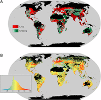
Source: Sanderman et al. (2017), PNAS
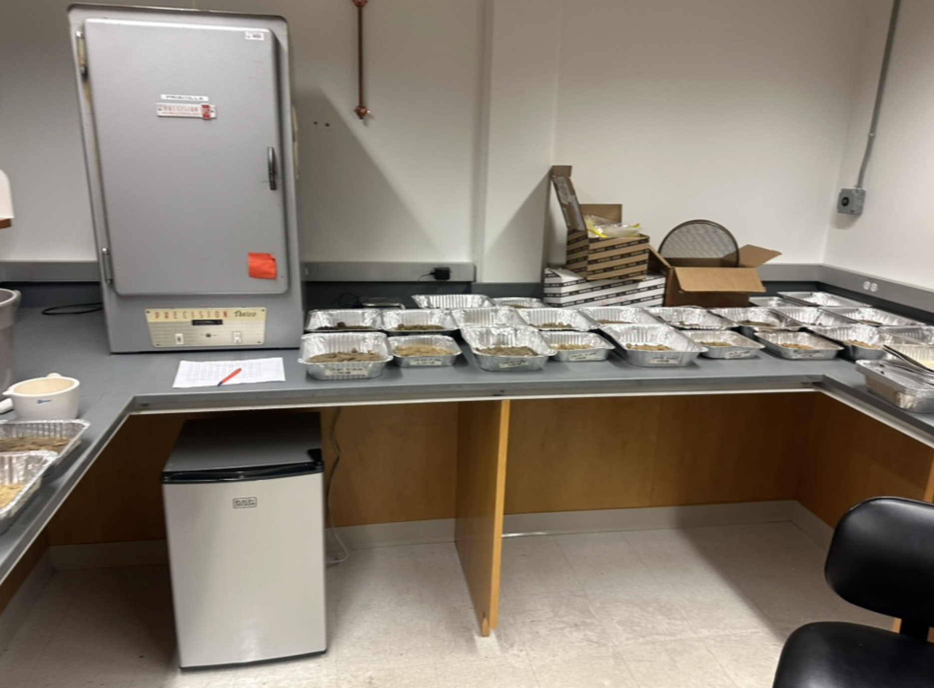
In 2024, Lamont researchers began a multi-year initiative to monitor changes in soil organic carbon (SOC) across spatial and temporal gradients. The project uses a grid-based soil sampling strategy to collect carbon measurements at 10-20 cm depths, combined with loss-on-ignition tests and spectroscopic models. These samples are taken across varied slope, elevation, and vegetation zones to detect how landscape features influence SOC storage and loss. Digital soil mapping (DSM) tools, coupled with remote sensing data from Sentinel and Landsat satellites, help extrapolate this field data to larger spatial scales.
This research also supports a broader modeling effort to understand the relationship between soil carbon stocks and dynamic environmental variables like moisture, temperature, and biomass. By comparing measurements over time, researchers aim to detect changes in soil carbon due to reforestation, climate variability, and management practices. The long-term goal is to use these measurements to inform regional carbon accounting and assess the climate benefits of natural forest regeneration.